
1900s
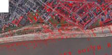
Coastal erosion (South beach, Lowestoft) 1906-2023 approx 200m! Measuring from the current cliff-top edge to the east of All Saints Church (as was) to the low-water mark on a OS 25-inch map, revised in 1903 and published in 1905. The lines in red are the old roads and buildings.
See also Dave Burt FB
Added: 23 September, 2023