
Index to LO&N Historical Articles (David Butcher)
 The work carried out on Lowestoft, listed below, is an attempt to reconstruct the community by showing various aspects of its history in earlier times - mainly during the Late Medieval and Early Modern periods, but with a small number of departures from these into both the 19th and 20th centuries. The method has been to use a multi-source approach, whereby study and interpretation of the local surface geology and topographical features combine with a wide range of available documentation to produce as detailed a picture as possible of the town and its inhabitants during different phases of its past. The work is ongoing, even after more than fifty years of study, and can therefore be adjusted or added to as new information comes to light.
[ by TITLE ] | [ by DATE ] | [ RESET ]


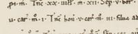

 - Suffolk Archives (Ipswich), Acc. No. 193/2/1.")


 - a modern construction of a 14th century Hanseatic cog, found buried in the River Weser’s mud in 1962.")
")


 - half a mile or so wider during the 1660s than it is now. Location of the post which marked the limit of Yarmouth’s trading jurisdiction, established in 1663")


")


 advertised the “Queen’s Head” premises, halfway down Tyler’s Lane (Compass Street) on the south side. Taken from the Isaac Gillingwater collection of illustrations (c. 1807): Suffolk Archives (Ipswich), 192/3/1.")


, founder of the town’s free grammar school in 1570. Described in the 1545 Rental as a messuage and fish-house, with the building-plot then stretching from the High Street down to Whapload Road")

 - Suffolk Archives, Ipswich - 193/2/1.")
, executed by Richard Powles in 1782. This was the town’s multi-purpose civic HQ until the Town Hall was built (1857-60). Suffolk Archives (Ipswich), 193/2/1 - the Isaac Gillingwater collection of illustrations.")
")


 - ink-and-wash study by Richard Powles, present in the Isaac Gillingwater collection of local illustrations (c. 1807) - Suffolk Archives, Ipswich (Acc. No. 193/2/1).")

 held by Suffolk Archives (acc. ref. no. 193/2/1).")


. Image to be found in Edmund Gillingwater’s history of the town, p. 299.")
, Acc. No. 368.")
, showing rod-and-line angling in progress. The tower of Kirkley Church is visible in the distance. View taken from the Isaac Gillngwater collection of illustrations (c. 1807) - Suffolk Archives (Ipswich), 193/2/1.")
 - this area being the surviving remnant of the Goose Green/Fair Green area referred to in text, once smallest of the town’s seven areas of common land")


 has the Gurneys, Birkbecks, Barclay and Buxton Bank located there, under the management of Henry Leman")

, bounded by Rotterdam Road on the west and crossed by Church Road. It was once a grazing area for the town’s milk cattle, referred to as “the common cow pasture of Lowestoft”")

.")
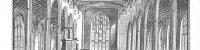
. An aisled structure, re-roofed during the second half of the 19th century and with cross-wing added at the front, its ground-floor framing was thought to date from c. 1500. Radio-carbon dating, using samples from five of the individual timbers, showed that the oak was felled during the winter of 1609-10. The building once served as the parish tithe barn")
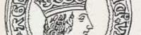
. Allin’s ship, the “Plymouth”, is shown flying its red flag below his right hand. Samuel Pepys. saw the overall work of portraiture under way in Lely’s studio during April 1666")
 - once forming part of Lowestoft’s soft, rural, western edge. The southern sector, between Dove Street and St. Peter’s Street, formed Goose Green. The northern part was the town’s Fairstead - Dove Street itself once being known as Fair Lane")


 - Isaac Johnson")

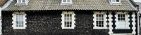
 at the time of his decease in 1636. The image used here shows the building before its dressed-flint facade was covered with unsuitable white masonry paint, many years ago.")


 - a merchant recently arrived in Lowestoft from Southwold, whose main business interests were in fishing and fish-curing.")


 - Suffolk Archives (Ipswich), 193/2/1.")


")

, executed by Richard Powles in 1782. This was the town’s multi-purpose civic HQ until the Town Hall was built (1857-60), with the curfew bell hung in the cupola surmounting the roof. Suffolk Archives (Ipswich), 193/2/1 - the Isaac Gillingwater collection of illustrations (c. 1807).")
.")


 - Suffolk Archives (Ipswich), 193/2/1")


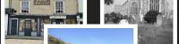
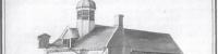
, built in 1914 by Colby Bros. Ltd. on the southern side of Lowestoft’s inner harbour.")


